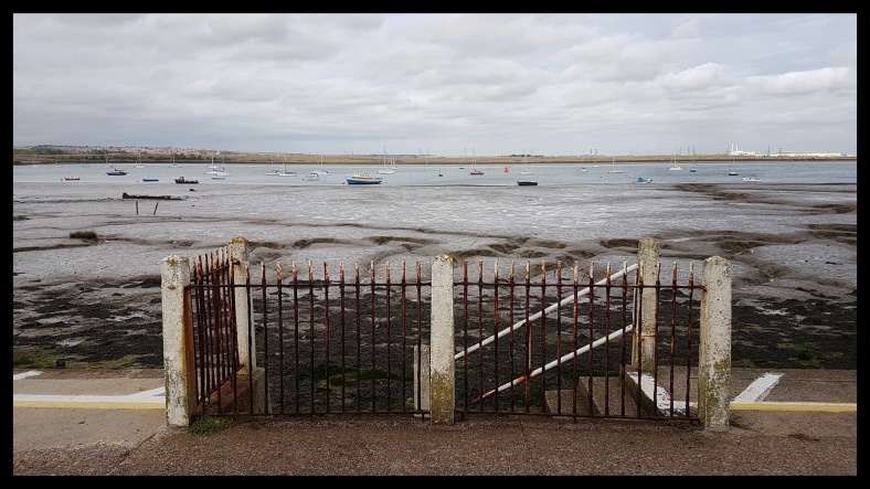
Day 11 : Cliff End – Hastings

Distance: 8 km

‘Now the sun had sunk. Sky and sea were indistinguishable. The waves breaking spread their white fans far out over the shore, sent white shadows into the crevasses of sonorous caves and then rolled back sighing over the shingle.’ (Virginia Woolf)

As soon as leaving Fairlight I enter Hastings Country Park, set in the High Weald AONB. The cliffs aren’t white coloured as of those around Dover, but have a soft sandstone brown colour. Open grassland, interspersed with bushes of still flowering gorse among them, covers the top of the cliffs. These cliffs are incised with steeply dense wooded gills. The little streams flowing at the bottom of the gills never cease eroding their surroundings with a patience only found in geological proportions. When descending the second gill, Glen Wood, I hear the cracking sound of a tree crashing. On my ascent out of the gill I have to crawl over a fallen tree. The fracture seems fresh and a newly established path around the tree is absent. I look as though one fine lady got lucky. These cliffs are constantly changing shape. The steep climb out of the next gill, Ecclesbourne Glen, is closed because of erosion.

20171009_111753-01.jpeg

Glen Wood.

After a detour and crossing a large patch of grassland I arrive at East Hill Cliff Railway, opened on August 10 1902. I have a splendid view overlooking Hastings and The Stade, home to the largest beach launched fishing fleet in Europe. I decide to take the East Hill Lift, the steepest funicular railway in the UK. For only a couple of pounds I’ll have a majestic arrival at Hastings, the end of the Saxon Shore Way.  Here I am, standing alone in the gracious wooden cabin, plummeting down, saluted by no one, ignored by everyone. The lift comes to a standstill, I squeezed the door open, and set foot in Hastings, surrounded by the noise of gulls, the sea… and cars. Job done. Yay!

“They only know a country who are acquainted with its footpaths. By the road, indeed, the outside may be seen; but the footpaths go through the heart of the land.” Richard Jefferies

20171009_125953-01.jpeg

Fishing stall at The Stade, Hastings.

Day 10

Copyhike by Roos Muylaert, 2017 – feel free to use this info to organise your own hike.

Day 10 : Kenardington – Cliff End

Distance: 28 km

‘Meanwhile the shadows lengthened on the beach; the blackness deepened. The rocks lost their hardness. The water that stood round the old boat was dark as if mussels had been steeped in it. The foam had turned livid and left here and there a white gleam of pearl on the misty sand.’ (Virginia Woolf)


20171008_121555-01.jpeg

Stone in Oxney church.

Between Kenardington and Appledore, the Saxon Shore Way crosses the extended vineyards of the Gusbourne Estate, producing sparkling wines. I couldn’t help tasting one of these grapes, the temptation of these little purple balloons filled with the essence of the sun was far too big to resist. And they tasted like a grape should taste, simply wonderful. Appledore was once a thriving port on the estuary of the river Rother, until great storms in the 13th century changed the course of the river Rother. Stone in Oxney sits prominent on the edge of the Isle of Oxney. Once a coastal island, now a large mound overlooking the Romney Marsh levels. Now I descend to the Royal Military Canal which soon joins the river Rother at Iden lock.

20171008_134516-01.jpeg

Reed flotsam on the river Rother.

By this time I have entered the county of East Sussex. In the far distance, Rye towers over the flatlands. The tide is rising on the Rother, and when I reach Rye, it’s impossible to follow the path under the railway bridge which is flooded. After a detour, I finally climb the steps leading to the old centre of Rye with it’s cobbled streets. Once an important member of the Cinque Ports confederation, Rye gained fame in the 18th and 19th century because of it’s notorious smuggling gangs, who met at The Mermaid Inn. Today it’s sunday, so I suppose it’s the smuggler’s rest day, ‘cause it was quite peaceful and friendly when I had my pint of Sussex Best Bitter at this beautiful six hundred year old Mermaid Inn.

20171008_145853-01.jpeg

The Mermaid Inn, Rye.

It’s late in the afternoon when I leave Rye for the coast. I follow the winding river Brede, past Camber Castle, built by King Henry VIII, to the base of the escarpment on which Winchelsea sits. I won’t climb the ridge, but instead turn left to join the last stretch of the Royal Military Canal to Cliff End, where the canal and the sea in times gone by kissed opposite sides of the lock. It’s remarkable to notice that the second town along the trail was Cliffe, and now nearing the end, the almost last but one village (only Fairlight fits in between) is Cliff End. It’s a pleasant thought to end my day on top of the cliffs. Tomorrow waits the grand finale of the Saxon Shore Way!

20171008_183131-01.jpeg

Cliff End beach.

Day 9Day 11

Copyhike by Roos Muylaert, 2017 – feel free to use this info to organise your own hike.

Day 9 : Peene – Kenardington

Distance: 31 km

‘The sun had now sunk lower in the sky. The islands of cloud had gained in density and drew themselves across the sun so that the rocks went suddenly black, and the trembling sea-holly lost its blue and turned silver, and shadows were blown like grey cloths over the sea. The waves no longer visited the further pools or reached the dotted black line which lay irregularly marked upon the beach.’ (Virginia Woolf)

Today is a day I’ll only be able to see the sea at a far distance. Firstly, I’ll round the Folkestone/Hythe agglomeration by means of the Folkestone Downs. And secondly, I’ll walk along the escarpment bordering Romney Marsh. A day of walking through an undulating patchwork of pastures, woodlands and fields. Since Dover, the Saxon Shore Way and the North Downs Way were close friends, clinging to each other for dear life. But the time has come to go our own way, and leave the NDW for what it is, to turn in a southerly direction on Tolsford Hill. The oaks and chestnuts have scattered their fresh

20171007_123052-01.jpeg

Lympne Castle.

treasures onto the path, my feet crushing them and pushing them into the earth and by doing so leaving a crisp noise in my wake.

‘In the poorest spots the hedges were bowed with haws and blackberries; acorns cracked underfoot, and the burst husks of chestnuts laying exposing their auburn contents as if arranged by anxious sellers in a fruit-market.’ (Thomas Hardy – Woodlanders)

At Lympne, formerly known as Portus Lemanis, I reach the old sea cliffs, now the Romney Marsh escarpment. Lympne is home to the medieval Lympne Castle and the neighbouring listed St. Stephen’s church. I descend the ridge to take a closer look at the Royal Military Canal, built because of Napoleon’s bigmouth: “All my thoughts are directed to England. I wait only for a favourable wind to plant the Imperial Eagle on the Tower of London.” Romney Marsh was the expected landing point for a French invasion. The canal was built with it’s accompanying parapet, and kinks in the canal to allow enfilading fire. But by the time the whole project was finished Napoleon’s empire was crumbling. Nowadays the canal is a place of peace and quiet to be enjoyed by wildlife and country walkers.

‘Here is a canal made for the length of thirty miles to keep out the French; for those armies who had so often crossed the Rhine and the Danube were to be kept back by a canal thirty feet wide at most!’ (William Cobbett)

20171007_161038-01.jpeg

Priory Wood.

Back on the ridge I keep walking the rolling countryside. This is definitely sheep country. Priory Wood once was a copse wood of the nearby St. Augustine’s Priory, now a wedding venue. Full grown multi stemmed trees makes me think of the coppice activity which must have once taken place during the winter months in these woods. The same activity I’m reading about amongst other things in Woodlanders. By the time I cross Ham Street Woods nature reserve dusk has placed a translucent sheet on top of the forest. Noise becomes more prominent. A grey squirrel is shouting for attention, a lady is calling for her runaway dog, I am quiet, observing these different kinds of behaviour. The colors are losing, almost unnoticed, their saturation. Until the sheet has become a thick blanket of black sweating out the day. My headlamp captures the raindrop, and thirty pairs of ‘glow in the dark’ eyes of sheep gaping at me as if I am the phantom of the night in person. But they’re wrong, it’s just me, the lady of the Saxon Shore Way, faltering between tufts of grass in search of a bivouac spot, the Horsemarsh Sewer.

Day 8Day 10

Copyhike by Roos Muylaert, 2017 – feel free to use this info to organise your own hike.

Day 7 : Chislet – Kingsdown

Distance: 34 km

‘The sun rose higher. Blue waves, green waves swept a quick fan over the beach, circling the spike of sea-holly and leaving shallow pools of light here and there on the sand. A faint black rim was left behind them.’ (Virginia Woolf)

20171005_161115-01.jpeg

Sea Wormwood (Artemisia maritima) growing on Sandwich beach.

At Upstreet in join the Great Ouse downstream. I don’t believe it! (I’m a ‘One Foot in the Grave’ fan). I’ve walked all those miles along the coast to see a seal here in the river, so many miles inland. His head above the the water, he looks me straight in the eyes before taking a deep breath, and off he goes, not to see him again. After a third of a mile I leave the Great Ouse at Red Bridge to join one of it’s tributaries, the canalised Little Ouse. It starts raining, I put my rain skirt, rain jacket and gaiters on, I cover my rucksack with a rain cover and open my umbrella. By the time I’m ready to conquer even the heaviest rain storm, the rain ceases. I don’t believe it! The Little Ouse joins it’s big sister the Great Ouse at Pluck’s Gutter. Behind a flock of sheep I can distinguish a slight elevation at the back of the field. It’s the remains of a saltworks. The OS map indicates numerous saltworks along the old Wantsum Channel. I have no idea from which time they date, but definitely from a time when the Channel was still filled with seawater, always or only at high tides, possibly somewhere in between. Suddenly the water catches my attention. The water is flowing upstream. It’s high tide out there at sea, the tidal surge pushes the freshwater back inland, quite fast. I’m used to the big tidal rivers, but this is a cute little one. After taking a look at the town centre, I round Sandwich along the Old Town Wall. The Saxon Shore Way crosses the Royal St George’s Golf Club to reach the shingle beach. The waves are crashing down on the pebbles, wave after wave endlessly trying to rearrange the stones, not knowing if to spit them further on the beach or to drag the stones back into the sea. Sea kale, sea wormwood and sea holly among them are growing between the shingle. On the opposite side of The Channel I can clearly distinguish the French coast, the white colour of Cap Blanc Nez and the grey of Cap Griz Nez. The low standing autumn sun irradiates the green hills and depressions shaped by the Royal Cinque Ports Golf Club.

I push the door open and nestle myself on one of the high benches lining the walls. In front of me a pint of some local ale. I’m at The Just Reproach Micro Pub at Deal. I get engaged with other beer enthusiasts. They love Belgian beers, I love English cask ales. My neighbour is the North Downs National Trail ranger. ‘Always follow the acorn!’ At last it’s time to leave. I push the door open and enter the night. The full moon glows helpfully, no need to put my headlamp on. The ales gave me an extra flush of energy and I stride along the dark beach with all its shadows of bushes and boats in the direction of the cliffs. The string of lights along the French coast decorate the black rocking sea. Nightwalking is a completely different experience, but it’s an agreeable one. One has to read the path like it’s braille. Every little bump in the trail is magnified. At Kingsdown I climb out of town and up on the cliffs to make my bed on top of Hope Point, to dream of seals and ales.

Day 6Day 8

Copyhike by Roos Muylaert, 2017 – feel free to use this info to organise your own hike.

Day 6 : Nagden Marshes – Chislet

Distance: 28 km

‘The waves broke and spread their waters swiftly over the shore. One after another they massed themselves and fell; the spray tossed itself back with the energy of their fall. The waves were steeped deep-blue save for a pattern of diamond-pointed light on their backs which rippled as the backs of great horses ripple with muscles as they move. The waves fell; withdrew and fell again, like the thud of a great beast stamping.’ (Virginia Woolf)

The first sign of the transition from the Swale to the North Sea shows itself in the appearance of shingle ridges on the saltings. The boundary between the two is called The Spit. All the creeks and rivers carry the stories and lives and histories, large and small, of all the people living along it’s banks to the Swale, which on her turn spits these out into the North Sea to be drifted away along the coast of Thanet and beyond. Stories of life and death and singing. Stories similar to the one of the Cruel Sister.

Whitstable beach huts.

I watched a flock of brent geese grazing the eel grass on the mudflats, then turned my head and smiled, whispering ‘North Sea, here I come!’. Along the pebble beach of Seasalter I reach the bustling seaside town of Whitstable. The coast is lined by a charming ramshackle of little houses and beach huts, often brightly coloured. The Harbour Street harbours the friendly Pie & Mash Shop where I had the traditional stewed eel and mash in an abundance of liquor. When I eat such dishes or drink real ale, it is so much more than just a meal or a drink. It is steeped in history, it connects one directly through the senses to ancient times. Ancient times continuing through these places. Whitstable is famous for it’s oysters collected from Roman times until today. The harbour is lively with activity, heaps of whelks are tucked on the quay. Gulls waiting for an opportunity to fill their stomachs. Stalls selling their catch. Located off the Whitstable coast on the Kentish Flats is an offshore wind farm. Dwarfed by the wind turbines one can see the WW2 Red Sands Army Forts far out in sea. Some alien-like structures, but now only little dots because of the distance. Entering Herne Bay, I feel a faint tremor and the sound of an explosion. Off the coast I see a big dark cloud rising. Ten minutes later I felt, heard and saw it again. At the deserted pier, I ask a passerby if he knows what these ‘rumours of war‘ possibly can be. ‘Ordnance testing at MoD Shoeburyness, on the other side of the Thames estuary, in Essex.’ This far. I get an eerie feeling. Time for a pint at The Prince Of Wales, a victorian local. On leaving Herne Bay, I get a glance of the cream coloured cliffs at Reculver. I walk on top of the cliffs and there I see the landmark, the Reculver Towers, shining bright in the evening sunlight. In Roman times, the roman fort of Reculver stood on a promontory at the north end of the Wantsum, a now silted up sea channel cutting off the Isle of Thanet from the mainland. When the fort was abandoned the Saxons founded a monastery on this site. By the 10th century the site ceased to function as a monastic house and became a parish church. In the 12th century, the twin towers were included. Here, I turn inland following the old Saxon shore, i.e. the lowlands of the silted up Wantsum Channel. Past fields and orchards, crossing the Whitstable-Margate train line and the busy A299 road, I find a wild camping spot in the vicinity of Upstreet.

Day 5Day 7

Copyhike by Roos Muylaert, 2017 – feel free to use this info to organise your own hike.

Day 5 : Conyer – Nagden Marshes

Distance: 20.7 km

‘The sun no longer stood in the middle of the sky. Its light slanted, falling obliquely. Here it caught on the edge of a cloud and burnt it into a slice of light, a blazing island on which no foot could rest. Then another cloud was caught in the light and another and another, so that the waves beneath were arrow-struck with fiery feathered darts that shot erratically across the quivering blue.’ (Virginia Woolf)

20171003_093230-01.jpeg

The remains of a jetty, a relic of the Uplees Explosives Loading Company.

Today’s stage is the last one meandering along the creeks and marshes of the Saxon Shore Way. Tomorrow I’ll be heading for my first view of the vast grey expanse which is called the North Sea. The big sky, on my left the levels, sliced to pieces by drainage channels and dotted with sheep. On my right side, the mudflats and saltings and the Swale and further, out of my reach, the Isle of Sheppey. In the middle of all this, the flood bank, dividing the green from the brown. And on this bank, me, walking in solitude, across a landscape silenced forever by a big bang which happened some hundred years ago. Every morning, the wind dries the tears shed every night by every single blade of grass on the premises of the late Uplees Explosives Loading Company. The lapwings, oystercatchers, curlews, redshanks and turnstones still mourn for that what happened on sunday 2nd April 1916. Imagine a brick-and-timber building filled with 15 tons of TNT and 150 tons of a highly explosive ammonium nitrate. On the outside of this building, tucked against the north wall, a pile of empty TNT bags. A spark from a nearby chimney, fitted with an inadequate arrester, was all that was needed to set the empty bags on fire. A brave attempt was made to extinguish the fire before it got out of control. 109 men and boys were killed by an explosion so great that the windows across the Thames estuary at Southend were shattered and the tremor was felt in Norwich. The whole area these days is an important nature reserve for migratory birds. Some lonely geometrically placed barracks, sheltering the sheep these days from bad weather, and the odd crumbling jetty are a silent reminder of this tragedy.

Shed at the Iron Wharf Boat Yard, Faversham.

Past the disused Harty Ferry I turn inland at the mouth of another Creek. Approximately two thirds of a mile the creek splits, like the forked tongue of a snake, in Oare Creek and Faversham Creek. At the confluence of these two creeks sits The Shipwright’s Arms pub, at a place called Hollowshore. I see this beautifully isolated weatherboarded pub on the opposite side of the creek but have to walk along the creek to Oare where I can cross the creek and then all the way back to reach this white weatherbeaten gem. I was here once, more than a decade ago, and knew that this old smugglers pub would be today’s highlight. I lay my hand on the doorknob and pushed the door of this 300 year old pub open. By entering the doorstep it was like traveling through time. Everything was just the same as all those years ago. All nooks and crannies to retreat oneself, casks stacked behind the counter, the walls decorated with maritime memorabilia. I will nestle myself here for some time, fish and chips on a plate, a pint of real ale at hand and a good book to read. I have a tradition of reading Thomas Hardy on my long distance hikes, he’s my perfect companion.

20171003_152944-01.jpeg

A still life at the Iron Wharf Boat Yard, Faversham.

After many hours, a full stomach, a couple of pints and turning lots of pages, I continue my walk, meandering in the sun along Faversham Creek. Arriving at Faversham I pass the impressive Shepherd’s Neame Brewery and at pretty Standard Quay, with it’s old barges and Monks Granary (one of the oldest surviving warehouses of Britain) housing cosy shops and tea rooms, I rejoin Faversham Creek. After crossing the Iron Wharf Boat Yard I’m again in the open, and past Nagden I see The Shipwright’s Arms for the third time this day. I salute and head in the direction of the Swale where I’ll pitch my tarp. Tomorrow waits the North Sea.

Day 4Day 6

Copyhike by Roos Muylaert, 2017 – feel free to use this info to organise your own hike.

Day 4 : Lower Halstow – Conyer

Distance: 30.2 km

‘The sun rose. Bars of yellow and green fell on the shore, gilding the ribs of the eaten-out boat and making the sea-holly and its mailed leaves gleam blue as steel. Light almost pierced the thin swift waves as they raced fan-shaped over the beach.’ (Virginia Woolf)

20171002_122936-01.jpeg

The Isle of Sheppey across the Swale.

Lower Halstow wharf and the adjacent church is a rather picturesque place. The low autumn sun sets the 8th century Saxon church wall on fire, the old yew tree towering over the graves remains dark, as it always does. The Saxon Shore Way tries to find the higher ground of Tiptree Hill, past a turf farm (I’ve always wondered were and how turf was grown) and his helpful farmer, before diving into the sunken lands of Chetney Marshes nature reserve. Cows are grazing the marshes, a handful of partridges fly off in their typical attention seeking style, a ginger flash of a fox, the always impeccable bright white egrets guarding the muddy creeks and the wailing sound of the lapwing and curlew.

“Almost heaven, Sweet Brittania
North Sea marshes
Long Reach Swale River,
Life is old there
Older than the creeks
Younger than the saltings
Blowin’ like the breeze
Country roads, take me home
To the place I belong
Sweet Brittania, mudflat momma
Take me home, country roads”

20171002_153838-01.jpeg

Shipwrecks along The Swale.

The Swale guides me under the Sheppey Crossing and past an industrial estate to the mouth of Milton Creek. I meander along its bank to Sittingbourne, where I follow the dull and busy B2006 to the other bank of Milton Creek. Happy to be back out of town and along the creek I soon reach the mouth again, but now on the opposite bank, where a disused oyster pond, now a nature reserve, reminds one that Milton Creek was once an important centre for the oyster industry. It’s late in the afternoon by now, the low standing sun illuminates the reed beds, every individual stalk radiates a golden glow. One of the reasons why I like hiking, and especially solo hiking, is because of the silence. I adore the silence of nature. The stillness in time and place. And this I find here and now, on the flood bank along The Swale. A bit further is another creek, Conyer Creek, low tide, mud, mud, mud, impossible to imagine a ship is even able to reach the marina at high tide. Conyer is an idyllic hamlet, white houses along the creek, ships and barges stranded on the mudflats, the quintessential pub which is called, what else, The Ship Inn. Conyer is the place to harbour myself for the night.

Day 3Day 5

Copyhike by Roos Muylaert, 2017 – feel free to use this info to organise your own hike.

Day 3 : Strood – Lower Halstow

Distance: 23.1 km

‘The sun had not yet risen. The sea was indistinguishable from the sky, except that the sea was slightly creased as if a cloth had wrinkles in it. Gradually as the sky whitened a dark line lay on the horizon dividing the sea from the sky and the grey cloth became barred with thick strokes moving, one after the other, beneath the surface, following each other, pursuing each other, perpetually.’ (Virginia Woolf)

20171001_094424-01.jpeg

Rochester.

The first part of today’s stage is going to be a city walk through the merged towns of Rochester, Chatham and Gillingham. By the time I reach the banks of the river Medway, the grey start of the day sprinkles a soft drizzle upon the city of Rochester. The stranded cold war Soviet submarine and the absence of people on this sunday morning gives the whole an eerie feeling. Crossing the Medway bridge seems to bring me back in time. The beautiful Baggins Book Bazaar, an alleyway with a timber framed building dangerously trying to kiss his opposite neighbour, Rochester Cathedral, the second oldest cathedral of England, cream coloured and flanked by a majestic Catalpa, and the grey Rochester Castle. Next along the Saxon Shore Way stands the red brick Restoration House, which was the inspiration for Miss Havisham’s dwelling in ‘Great Expectations‘.

20171001_100427-01.jpeg

Rochester Castle.

By the time I reach Chatham the drizzle had stopped, and at the Gillingham sports ground I saw teenagers and their parents dreaming of the Premier League. I, on the other hand, was dreaming of a dark pint of real ale which I found at the Past & Present Micro Pub a bit further down the road. The blackboard on the wall offered a beautiful array of Kentish ales and ciders, on gravity straight from the cask. Oh, how I love those places. It’s all back to basics, the pub as a meeting point whilst sipping a pint of quality. After a chat about beer and walking I stumble out of the pub in the direction of the estuary, the Riverside Country Park with it’s extended mudflats.

20171001_145423-01.jpeg

Gillingham marshes.

The sun appears now and then, and numerous families are enjoying their sunday afternoon stroll along the coast. Now it’s all peace and quiet but in earlier times this stretch of the estuary was bustling with activity. Copperhouse Marshes refers to the copperas works, a product which was used for tanning and as a dye for woolen cloth. Motney Hill and Horrid Hill were the sites of cement works. Chalk was excavated from nearby pits and at high tide ‘Muddies’ sailed their barges down the river to collect mud from the mudflats at low tide. As the tide came back in, the barges would re-float and the mixed chalk and mud fired at high temperatures to create cement. Bloors Wharf was once a fishermen’s wharf and later a scrap yard and a ship breaker’s site. From the

20171001_203743.jpg

The Three Tuns pub, Lower Halstow.

wharf at Otterham Quay to Hamgreen saltings the Saxon Shore Way passes through numerous orchards, their boughs laden with blushing apples ready to be picked. The sun is setting while I walk on the flood bank bordering the saltings. Blue smoke is curling from the chimneys of the two houseboats at little Twinney Wharf. I pitch my tarp in the old copses at Lower Halstow, put my headlamp on and leave in search of the cosy Three Tuns pub.

Day 2Day 4

Copyhike by Roos Muylaert, 2017 – feel free to use this info to organise your own hike.

Day 2 : Eastcourt Marshes – Strood

Distance: 26.65 km

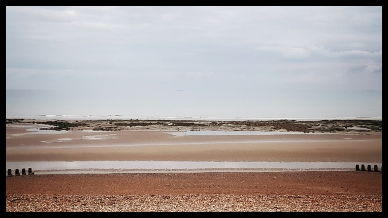
‘As they neared the shore each bar rose, heaped itself, broke and swept a thin veil of white water across the sand. The wave paused, and then drew out again, sighing like a sleeper whose breath comes and goes unconsciously.’ (Virginia Woolf)

The river Thames.

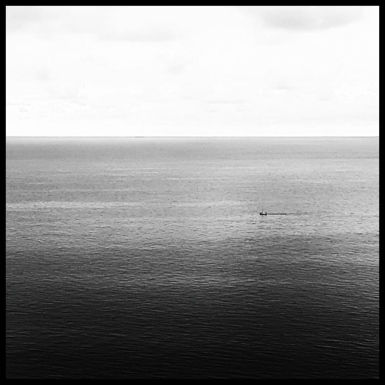
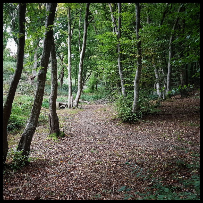
The super dark ND filter of the night melted down at first sight of an early autumn morning sun. My eyes popped open, a smile appeared and my body excitingly geared up for a day along the trail. I stumbled out of my cosy sleeping bag and tarp in search of a first clear view of my dear river Thames. I grew up along the magic of a tidal river and it somehow feels like a homecoming, and at the same time eager to see the diversity, walking the banks of ‘a river not knowing where it’s going or where it’s coming from’. Having breakfast while sitting on a little concrete wall on the bank with my head in the clouds and my feet among tufts of slimy brown bladderwrack, I feel fine.

“And please, what’s Hulks?” said I. “That’s the way with this boy!” exclaimed my sister, pointing me out with her needle and thread, and shaking her head at me. “Answer him one question, and he’ll ask you a dozen directly. Hulks are prison-ships, right ‘cross th’ meshes.” We always used that name for marshes, in our country. (Charles Dickens)

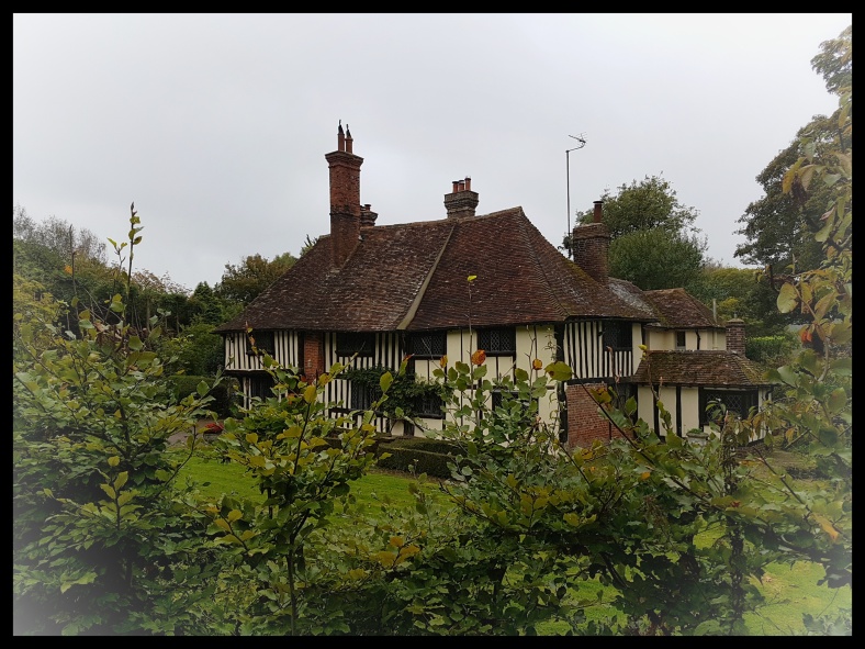
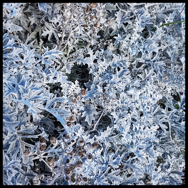
Gads Hill Place in Higham, only a stone’s throw away, was the country retreat of Charles Dickens, and the countryside between Chatham and Gravesend was no stranger to him. I have great expectations of today’s stage, being the setting of much of Dickens’s ‘Great Expectations‘. Dickens moved the prison-ships he saw on the Medway estuary to that of the Thames in his ‘Great Expectations‘ novel. It’s quite easy to imagine this scene today: the river merging into the salt marshes where a possible fugitive, his clothes wet through and weighing heavy, after having narrowly escaped the undercurrents, is getting stuck knee deep into sticky mud, surrounded by samphire and sea lavender.
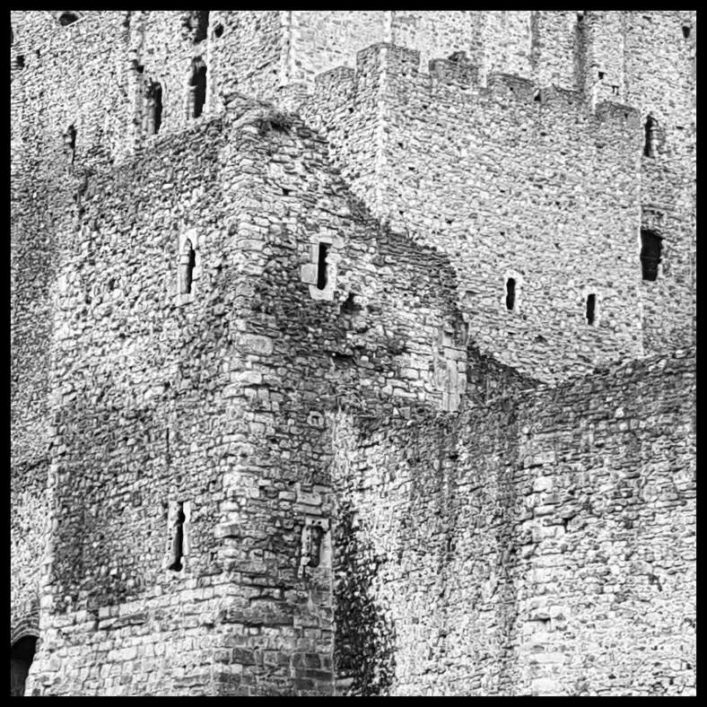
20170930_091454-01.jpeg

Shornemead Fort.

A flock of goldfinches moves nervously around the graffiti clad remains of Shornemead Fort. This artillery fort was built during the 1860’s to support other nearby forts against seaborne attacks, but its location on marshy ground led to major problems with subsidence and was henceforth disarmed by the early 20th century. Now only the brightly coloured front of the casemates survives.
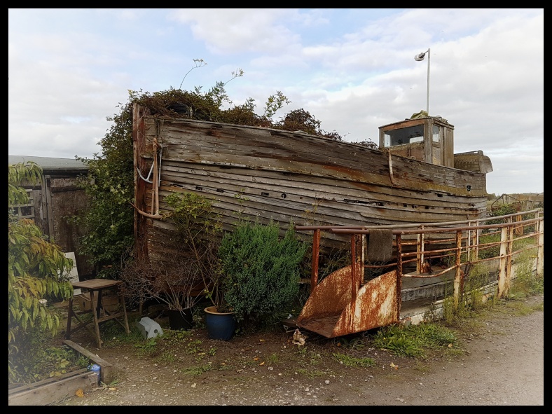
A herd of slovenly Konik ponies grazes the marshes, consisting of Sea aster, sea lavender, samphire, cordgrass and searocket among them; the beached wreck of the Hans Egede in the background. This was a Danish wooden 3-masted vessel built in 1922, reported damaged by fire close to the North Hinder light vessel in 1955, and after a stopover at

20170930_100927-01.jpeg

The Hans Egede wreck.

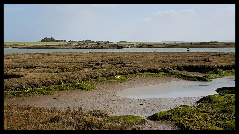
Dover and the Medway the ship retired here, near Cliffe Fort. The wreck is now a gateway to the past and the home of numerous species of seaweeds. Cliffe Fort was built during the same period as Shornemead Fort and encountered the same problems with subsidence. Cliff Fort, now fenced off, is possibly most famous as the fort where the first torpedo launcher was installed, at the end of the 19th century. The Saxon Shore Way passes the Brennan torpedo rails, before going underneath the conveyor of the aggregates works. I leave the Thames at Cliffe Creek and enter the inland of Hoo Peninsula, past the lagoons of ‘Cliffe Pits and Pools’ Nature Reserve. Here is see the first of many egrets, the illuminated jewels of the mudflats and creeks along the Saxon Shore Way. On top of the white chalk escarpment nestles Cliffe village, a reminder of the sea which must once have splashed beneath the town. The Kentish rag and flint St. Helen’s church shines in the sun. Crossing the fields between Cliffe and Cooling, a pilot is having fun in his little agile plane, happily making acrobatic circles, swooping low over the fields, drawing a smile on my face.

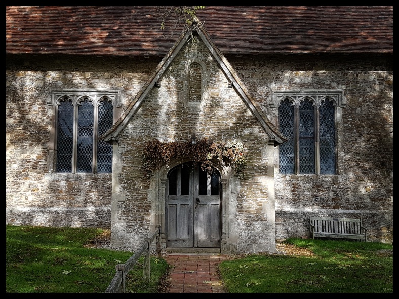
The opening scene of Great Expectations, Cooling churchyard.

The dangers of marshland life. Not this plane, but gnats, marsh fever, ague or malaria. The last outbreak occurred in 1918, when English mosquitos are thought to have picked up the malaria parasite from soldiers returning from Greece and India. An eighteenth-century historian described the marsh dwellers as being of a ‘dingy, yellow colour’ thanks to their distempers, and recorded that ‘it’s not unusual to see a poor man, his wife, and whole family of five or six children hovering over their fire in their hovel, shaking with an ague all at the same time’. This family could easily have been the Comports, whose graves at Cooling churchyard make clear. Beneath the headstones is arrayed a terrible legion of dead babies, each one marked by a small, sad lozenge of grey stone: thirteen lost infants in all. Dickens opened his novel ‘Great Expectations‘ in this bleak, abandoned place, these graves.

‘At such a time I found out for certain that this bleak place overgrown with nettles was the churchyard; and that Philip Pirrip, late of this parish, and also Georgiana wife of the above, were dead and buried; and that Alexander, Bartholomew, Abraham, Tobias, and Roger, infant children of the aforesaid, were also dead and buried; and that the dark flat wilderness beyond the churchyard, intersected with dikes and mounds and gates, with scattered cattle feeding on it, was the marshes; and that the low leaden line beyond was the river; and that the distant savage lair from which the wind was rushing was the sea; and that the small bundle of shivers growing afraid of it all and beginning to cry, was Pip.’ (Charles Dickens)

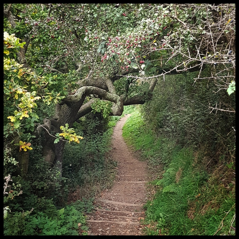
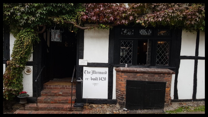
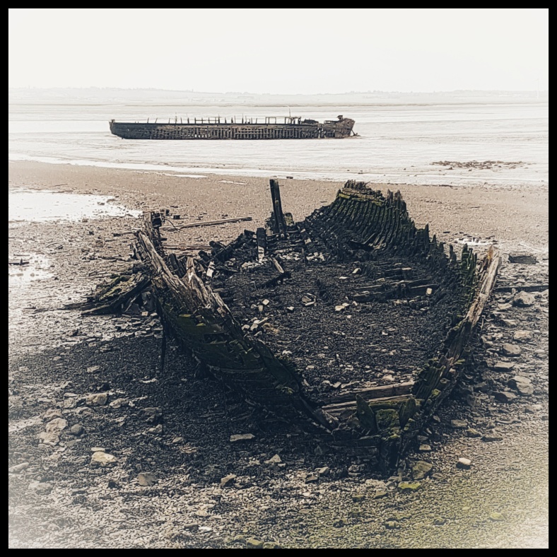
After a break and a decent pint at The Horseshoe & Castle Inn, I resume my walk. Through orchards and after a steep walk up the wooded Northward Hill, the view across Hoo Peninsula is far reaching. From now on it’s slowly descending in the direction of the Medway estuary. The tower of Grain Power Station will be the landmark for the upcoming days. An overgrown Bessie’s Lane takes me to Fenn Street. This lane, a reference to Elizabeth I, is believed to be the route used by the queen on her journey from London to Chatham Dockyard in 1573. At Hoo I decide to take the lower route along the banks of the Medway. It’s low tide and the extensive mudflats of the river show their full glory, creeks drawing coiling lines on the brown and green canvas, dotted with the derelict hulks of boats. Hoo Marina is a weird place. Don’t expect a fancy, snobbish marina, no, it looks like a safe harbour for outsiders: Hoo Marina Park, loads of fly tipping, the marina itself a ramshackle of boats spitting the wrecks on the nearby mudflats, no shiny white boats but the smell of metal and oil, no sailors in fancy clothing

20170930_165013-01.jpeg

Cockham Wood Fort.

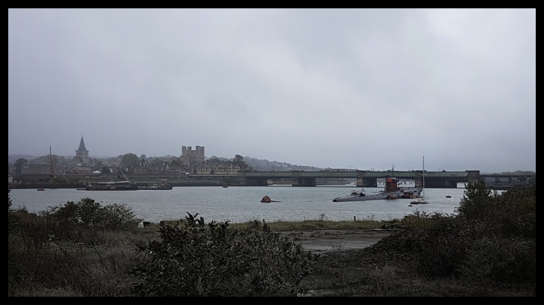
but those used to heavy duty, beautifully strange houseboats. I like those places, little social code, what you see is what you get, no varnish needed; but I don’t like fly tipping, it’s such a shame. beyond the marina is a pebble beach along a steep wooded bank. The remains of the red brick Cockham Wood Fort contrasts beautiful against the dark foliage of the trees. Oak and the occasional elm line the beach. The fort was built in 1669 as a direct result of the Dutch raid on Chatham Dockyard in 1667. Upnor Castle further upstream took for the previous hundred years on the role of defending the dockyard. Behind the castle is a picturesque cobbled street leading back to the shore. Now the river is dotted with sailing boats, in Dickens’s time prison-hulks floated instead on this same river. I started the day with Dickens, and I will end it with him. Dusk is falling rapidly. Close to the 64 metres long early medieval tithe barn of the Manor Farm at Strood I put up my tarp, cook my meal and fall asleep.

Day 1Day 3

Copyhike by Roos Muylaert, 2017 – feel free to use this info to organise your own hike.

Day 1 : Gravesend – Eastcourt Marshes

Distance: 4.75km

‘As if there were waves of darkness in the air, darkness moved on, covering houses, hills, trees, as waves of water wash round the sides of some sunken ship’ -Virginia Woolf-

After a day of traveling I washed ashore at Gravesend. The sun had already set, soon the railway station was becoming quiet again after a sudden burst of frantic noise and movement which spat out a handful of travelers, mostly commuters, some shoppers and one rambler. The Thames shone an oily black, irradiated by the lights of Tilbury Docks, some scattered boats and Gravesend’s life; wavelets lapping lazy against the posts of the pier.

The LV21 Lightship, Gravesend.

Gravesend fits perfectly as the starting point of a long distance trail, of a new adventure; hence it’s history of new lives and new adventures by means of migration. Punjabi Sikhs arriving in search of jobs, English families and young men excited to board the ships at Bawley Bay heading for the New World. Gravesend’s most famous anecdote is definitely the visit and death of Pocahontas. The coming days I’ll migrate along the Saxon Shore Way, past old and new shores, to Hastings, in search of beauty.

The Saxon Shore Way begins at the Gravesend Town Pier, the oldest surviving cast iron pier in the world, built in 1834. Close by, and next on the trail, is Bawley Bay. No more ships sailing to Australia and New Zealand, no more shrimp boats boiling their catch at the bay. The town opens up at the New Tavern Fort, the first bead on a string of defensive structures nestling the North Sea coast. Defense is one of the main themes of the Saxon Shore Way. The fort was built during the American War of Independence to guard the Thames against French and Spanish raiders operating in support of the newly formed USA. Redesigned and rebuilt, the fort, now a riverside leisure area, was last used during the Second World War. Crossing the locks at the marina, the town closes in again (I put my headlamp on) and the trail heads through the empty backstreets of a crumbling industrial estate. I hear some muted noise and laughter around the corner and it seems like the whole area is attracted to the Ship & Lobster like moths to a flame. This is the pub mentioned in Dickens’s Great Expectations.

‘Leaving the rest in the boat, I stepped ashore, and found the light to be in a window of a public-house. It was a dirty place enough, and I dare say not unknown to smuggling adventurers; but there was a good fire in the kitchen, and there were eggs and bacon to eat, and various liquors to drink.’ -Charles Dickens-

Past the pub I climb the flood bank along the river Thames. Here I am at last. Out in the open, the smell of salt marshes, the faint noise of wavelets trying to grasp the shore and a surprisingly warm late september breeze. Saxon Shore Way, I am ready to embrace you!

Day 2

Copyhike by Roos Muylaert, 2017 – feel free to use this info to organise your own hike.